Karnataka Physical Land Survey

ಕರ್ನಾಟಕ ಭೌತಿಕ ಭೂ ಸಮೀಕ್ಷೆ

Product image
Product image

Overview

Last updated: June 20, 2026
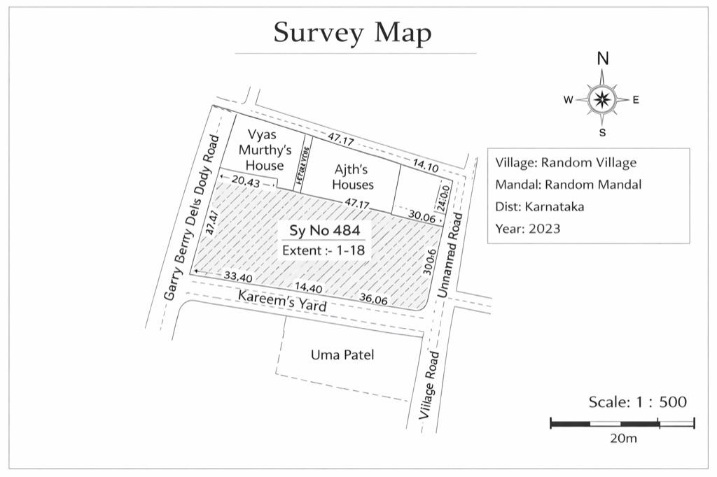
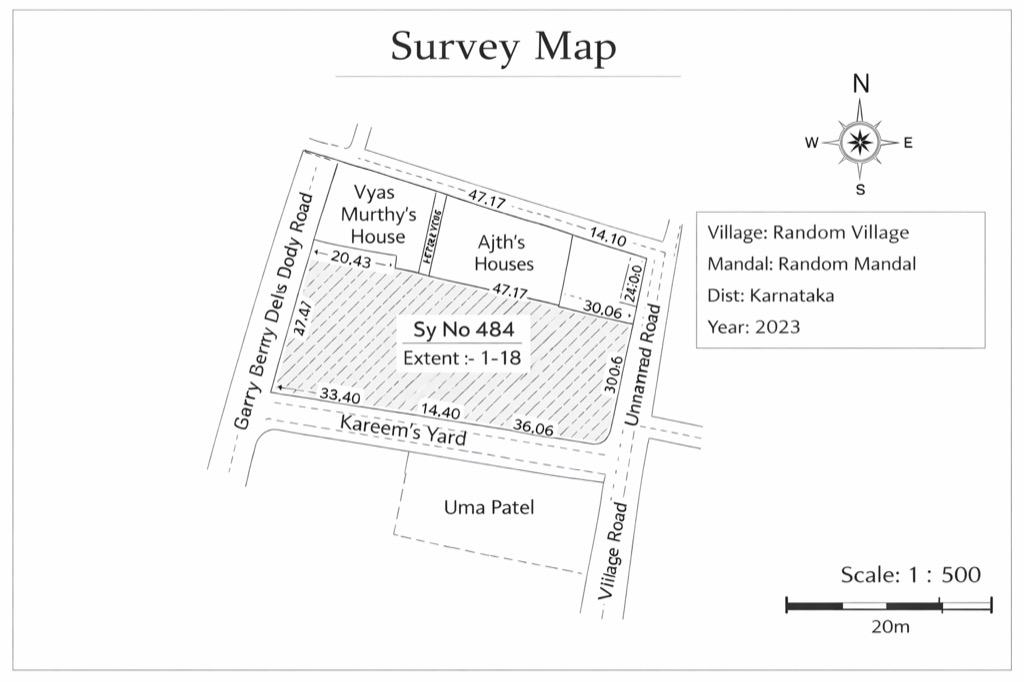
A Physical Land Survey is a ground-level measurement of a land parcel to confirm the exact boundaries—where the land starts and ends—and the actual area on-site. This is useful because land records may show a survey number and area, but on the ground the boundary may not be clearly marked, especially with fencing, neighboring plots, or old markings. A physical survey helps bring clarity before you take important steps like selling the land, starting construction, splitting the land, or handling a boundary issue with a neighbor.

Use cases

Why Landeed?

mdi:tick
Free searches *
mdi:tick
Guaranteed document delivery
mdi:tick
24/7 Customer support
mdi:tick
Soft copy and hard copy
mdi:tick
All day access

Ratings & Reviews

Google Play Store

Extremely efficient

excellent Mr. Ramu was very nice and help full 👍 he is extremely efficient.

Parag Jaju3 months ago
Google Play Store

Transparent and prompt

I availed thier services for Khata transfer & mutation recored update. Ramesh was transparent on all the fees & promptly updated on timelines. Will be referring any friends for such services

manj gul1 month ago
Google Play Store

User friendly app

The app is very user friendly and the team is extremely helpful. They handled my requirements very well and completed the job in a timely manner. Their fees for the jobs are also very reasonable. Very happy to have used their services. Thank you Ramu and Rohit for the wonderful service.

Kavitha J3 weeks ago

FAQs

What is a Physical Land Survey?

It is a land measurement done on-site to confirm boundaries and the actual land extent on the ground.

Who should request a Physical Land Survey?

Anyone who wants boundary clarity—especially before sale, construction, or if there is a boundary confusion with neighbors.

What do you get after a Physical Land Survey?

You get measurement details and clear boundary marking information that helps you proceed with the next steps.

What information is required to request it?

Survey number, village/taluk details, owner details, and any available land records (like RTC or a sketch).

Is it needed before construction?

It's strongly recommended. It helps avoid building outside your boundary by mistake.

Can it help with neighbor boundary disputes?

Yes. A physical survey helps clarify where the actual boundary line lies on the ground.

Can this be requested online?

Request methods can vary by area. With Landeed, users can manage the request and documentation digitally.

Need some help?

bx:support
Get Support
mdi:chevron-up
Product image
Product image

KA Physical Land Survey

KA Physical Land Survey confirms land boundaries and on-site land extent.

  • Confirms where your land starts/ends
  • Useful before sale or construction
  • Helps in neighbor boundary issues
  • Supports clean verification

Looking for other land documents?

Find Deeds, Titles, and More – All in One Convenient Place

v0.69.2Landeed is not a government entity and is not affiliated with any government agency